A change of plans
This hike was a fusion of revisiting locations for me, but for Jim it was completely new territory. We had planned on a different hike in the area, but if bad weather were to persist I had this location as a back-up. So rather than stomp around the Hudson River Gorge Primitive Area in foul weather we ended up in the Vanderwhacker Mountain Wild Forest. It had been several years, actually more than a decade, since I'd been to Rankin Pond and on a couple of the nearby peaks. It was certainly the right time to visit an old friend.
Crusher Hill is “something old”
Crusher Hill is one of the small peaks I visited some time ago, making it “something old” for the day (and you thought I was talking about Jim). We wouldn’t actually set foot on a trail until the end of the day. With Crusher Hill directly over us, we opted for the direct route of attack. We walked about 50 feet to the right of the trail register, jumped the berm and hit the woods. We love this region for its open forest, and in its current state of leafless November it was like a walk in the park. The dull sky above us didn’t cast a shadow and the threat of rain was hanging over our heads, but we would roll with the punches as we so often have in the past.
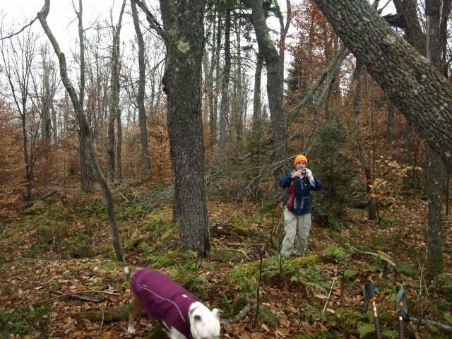
It wasn’t long before we crested what was left of the small hill and stood atop the open rise, looking through the leafless trees at the surrounding mountains of the region. We didn’t hang around because we still felt like we were racing the weather. The dark clouds billowed above us and a cool northerly breeze hit us on the cheeks with that crisp smell of fall in the air. We could see Balfour Lake below us — we would seek that out next.
Balfour Lake is “something blue”
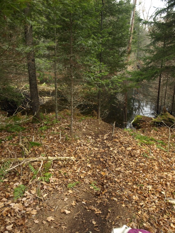
We dropped off of Crusher Hill on a soft bed of leaves resembling a footing of sheer ice, but even with every effort to remain in the vertical position we failed. It wasn’t long before we gained the drainage of Rankin Pond. Before us stood a two-tiered beaver marsh — flooded too deep and too wide to hop, we would have to head downstream to find a good place to access the other side. The thick lining of spruce and fir made passage a bit slower, but in a short amount of time we managed to find a few rocks to hop, which provided a dry outcome to our crossing.
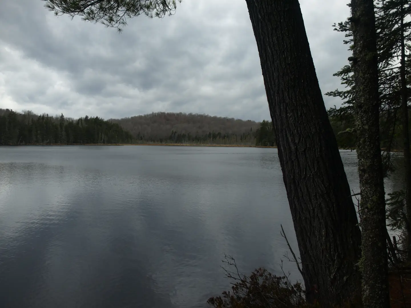
We kept following the drainage as the forest opened up around us and a sharp edge to the tree growth gave us the added pleasure of adventure. We descended ever so slightly and came upon an old forest road, maybe a carriage road to an old camp. While easy to follow, toppled trees blocked it from easy passage. Mud and running water infiltrated our boots. Balfour Lake below us called our name, but we waited to reach the small finger bay before we would take to its shore. The lake is a massive body of placid water, gleaming before us, and the camps on the opposite side lined the shore. A few pictures later we returned to the old carriage road. Now following an inlet to Balfour Lake, we climbed steadily to a high saddle between Balfour Mountain and Rankin Pond Mountain.
Balfour Mountain is “something new”
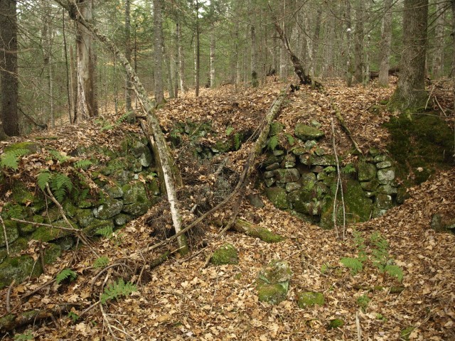
New to me, and new to Jim, we were excited to see what was in store for us on Balfour Mountain. The carriage road all but disappeared in the col near a small seep, so we were now on our own. The destination of the carriage road was now apparent as we stood near an old stone foundation.
From here it would be a moderate hike through more open forest. As we penetrated the countryside I would reflect on my past outings in the area and wonder why I never made my way to Balfour Mountain. Its summit lies so close to the main highway and quite close to other peaks I had visited.
The summit of Balfour consists of two nearly identical bumps, but looking at the map it was unclear which one was higher and by how much. I guess we would just have to visit them both. The first one was clogged with entwined mountain ash, which made it tough to move through, but with pushing and pulling we stood atop this wooded island. It appeared the other small knob was just slightly less than a quarter-mile away in an “as-the-crow-flies” direction. We would be there very quickly. With minimal descent off of the other side, we could see it from the shallow saddle. This top was totally different than the last. It was spruce covered, not densely so, but still a totally different tree growth. We dropped a bit to the lake side and managed to grab a slight view toward Green Mountain and Hewitt Pond Mountain. Again, the summit was wooded, but at least we found a decent viewing platform.
We moved off and over the first summit back to the col between Balfour and Rankin Pond Mountain. The descent was a bit more to the west than our climb just a few minutes prior, and to our pleasure it was much more open. In fact, it was a wonderful stand of hardwoods.
Rankin Pond Mountain is another “something old”
We were down quite fast off Balfour Mountain and along the way we came across another old foundation-type structure. It might have even been an old stone pile from a property corner. Just beyond this was the old carriage road we followed earlier, this time in fine condition and ever-so-obvious. We would not follow it this time as it passed over the valley toward the Boreas River (destination unknown, but we sure were curious). After crossing a narrow wetland by hopping from tufts of sedge to decaying logs, we made it across no wetter than we already were.
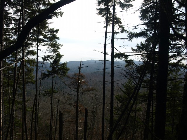
The climb up Rankin was hardly noticeable, aside from one steep section that lasted all of a few hundred feet. I remember finding views off of this 2,265-foot summit, or at least near the summit, and I was hoping to find more of the same. Then it happened — there was some sort of bright object in the sky, almost blinding and nearly disorienting, but we were not so sure what it was and then it was gone. Come to find out later it was the sun, but it had been so long since we saw it we were confused.
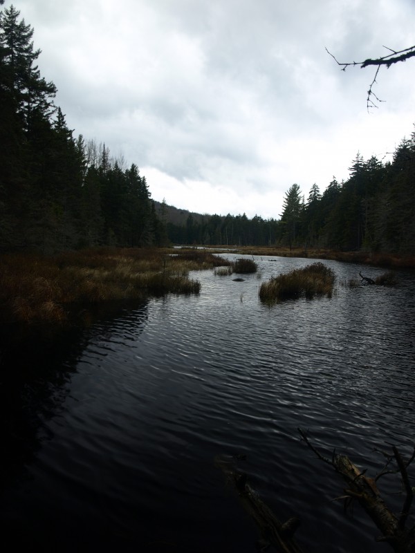
Rankin Pond is another “something blue”
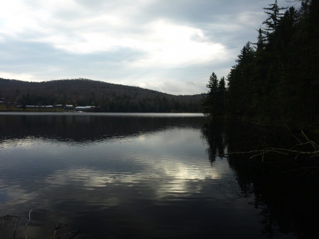
Our last destination of the day was Rankin Pond, where we picked up the trail back to the car, but first we would have to get off the top of this guy. We started to descend toward Little Rankin Pond, but the day was getting shorter and the darkest of the day's clouds started to spit on us a bit. To avoid a drenching, we ended up veering back toward the Rankin Pond outlet to shorten the course. The outlet in this area was actually right near where we crossed it earlier in the day, and thankfully downstream from the beaver flood zone.
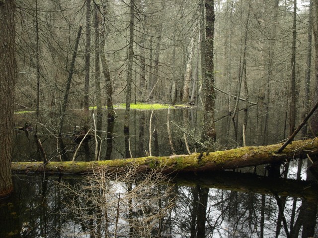
We walked the outlet up to the beaver village to get a closer look. The rain had subsided again so we felt more freedom to explore. The flooded area was quite large with additional tiers of small ponds with green, moss-covered, downed logs and standing snags. It was picturesque. Soon we came to a long finger of Rankin Pond, which was still over a quarter-mile away from the end of the trail. We walked the shore as best we could but the growth was thick. Until we finally found a fisherman’s path, we had a heck of a time of it.
We took some photographs of the pond but as gloomy as it was, they weren’t all that great. Finally, and I say finally with a slight sigh of relief, we were on the trail. This path looked to be used quite often, but not maintained equally as much. Several pieces of downed branches and full trees covered parts of the trail. They had been there so long paths were developed around them. Too big for us to move, we had to use the paths as well. The trail is only 0.4 miles or so from pond to road, so as you can imagine we made quick work of it and were back at the car in no time.
I was chilled from the damp weather and the sweat on my back, and a slight shiver in my spine made me jittery for a hot cup of coffee. We would head into town and grab that as soon as humanly possible — with a couple squares of a Hershey’s chocolate bar melted in, it would be heaven.