A couple of weeks prior to this jaunt in the woods, Jim and I found ourselves pondering the idea of doing a hike in the Hudson River Gorge, but the ill-weather forecast caused us to choose a different hike, which brought us in the region near Balfour Lake. The weather prediction for the day, which I fully believe is determined behind the scenes with a roll of the dice, was projected to be partly sunny with a 20 percent chance of rain. We could live with that.
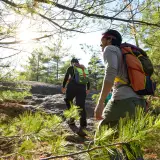
Jim wasn’t exactly sure where to go, so we met at the corner of Route 28N and North Woods Club Road. We then caravanned down North Woods Club Road, spotted a car at the railroad tracks and continued on to the trailhead for Blue Ledges. It had been a few decades since I had been along this trail but I had fond memories of hiking it with my dad to do a bit of trout fishing. I was fairly sure the trail hadn’t changed much, but who knows over the turning of the years if reroutes had taken place or if the trail was deeply eroded. In all actuality it wouldn’t matter — it was just nice to be there once again.
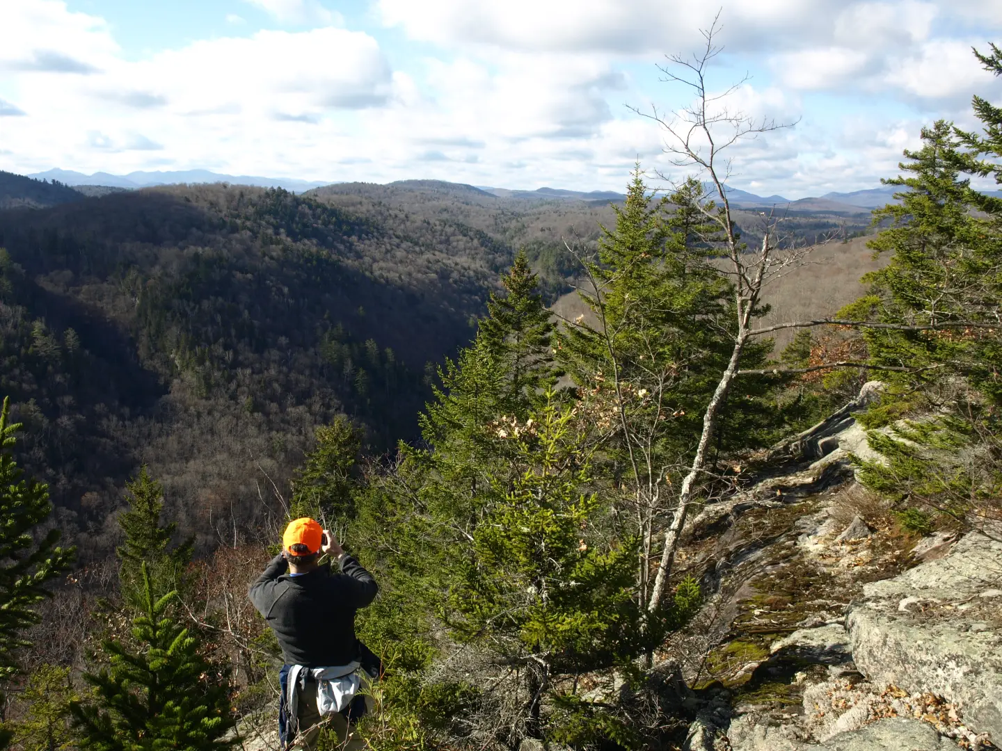
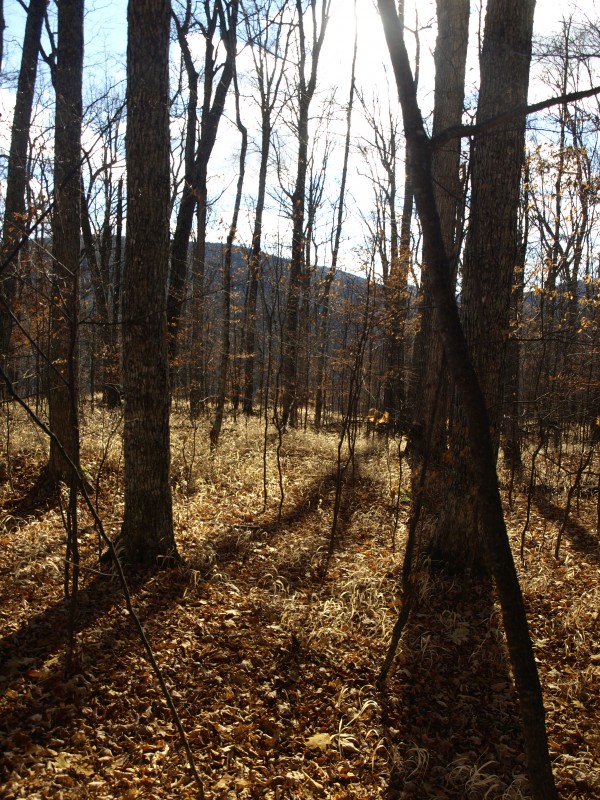
The trail to Blue Ledge
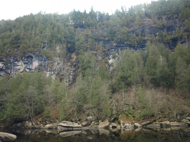
We quickly passed along the muddy trail that skirted the shore of Huntley Pond. The sun was just casting its shadows over the water. We made fairly quick work of the 2.5 mile trail as it routed us up and over rolling terrain. We were welcomed by a flock of geese ushering in the fall season as we reached a high point of land with the Blue Ledges just slightly beyond. It was a sobering note that the warm weather would soon be leaving us for six months, but today would not be the day. The warming rays of the sun were finally increasing the temperatures and it wouldn’t be long before we would shed the morning jacket. We descended to the Hudson River. Standing on a lovely sandy shore, we looked across a deep pool in the Hudson to the Blue Ledges as they glistened with running water.
From here we would look to head up Kettle Mountain, a popular little trailless peak for those who enjoy off-trail adventures. We had never been to this area in such a context and we couldn’t wait to get rolling. We followed the shore of the river, rock hopping as needed, but a decent herd path leading to campsites aided our travels. Soon the path would all but end before us, and we were presented with steep slopes and open hardwoods to get us up on the ridge. High above the Hudson River, the ridge runs through the Hudson Gorge Primitive Area.
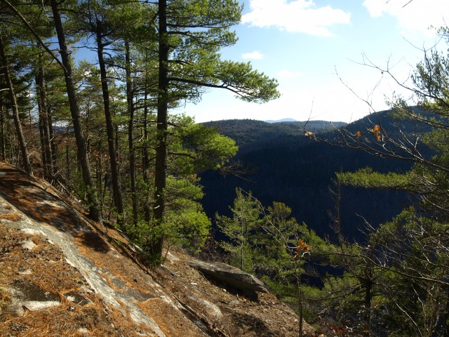
Kettle Mountain
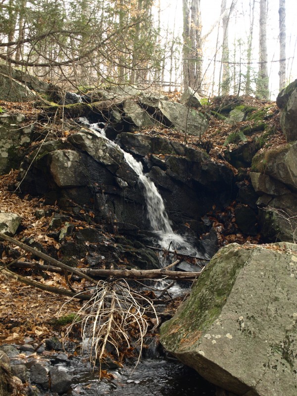
The terrain was steep, almost too steep to get decent traction on the moist soil and slippery leaves. We remedied this by heading on more of a side slope to gain the ridge. It wasn’t really that far to get up high, and in relatively no time we started to see potential viewing areas. I say potential because they never really worked out to offer much. However, just as we started to feel skunked on sights we popped out on an open ledge with great outlooks down the gorge. Kettle Mountain was getting closer and closer by the step, but our curiosity between here and there was focused on two streams that looked to be cascading over the steep side of the ridge. Would they provide some decent waterfalls? Well, the first one actually did have a small one up higher on the ridge, but to seek out others downstream would mean descending dramatically, and that was not an option for today. The second brook came much later in a deep dell, once we made our way through the forest.
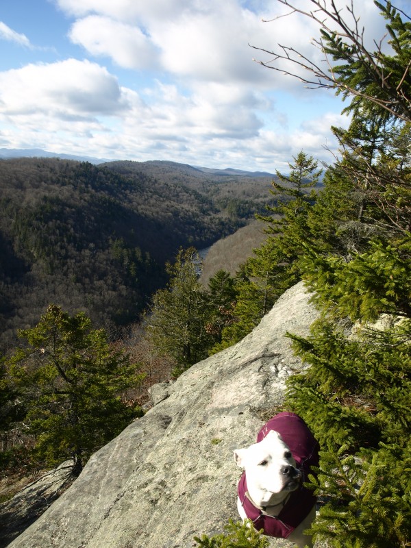

Crossing over the second stream, which at the point of crossing offered no dramatic whitewater, we started to climb Kettle Mountain. It wasn’t much of a climb from here as we did most of it to just gain the ridge from the Hudson. We summited rather quickly and ended up pushing our way through a bit of thick spruce. Once on the upper works of the mountain the views started to appear and around each corner they got better. This was sure to be our lunch counter with the spectacular views of Starbuck Mountain, P Gay Mountain and a unique view of OK Slip Falls deep in the valley below.
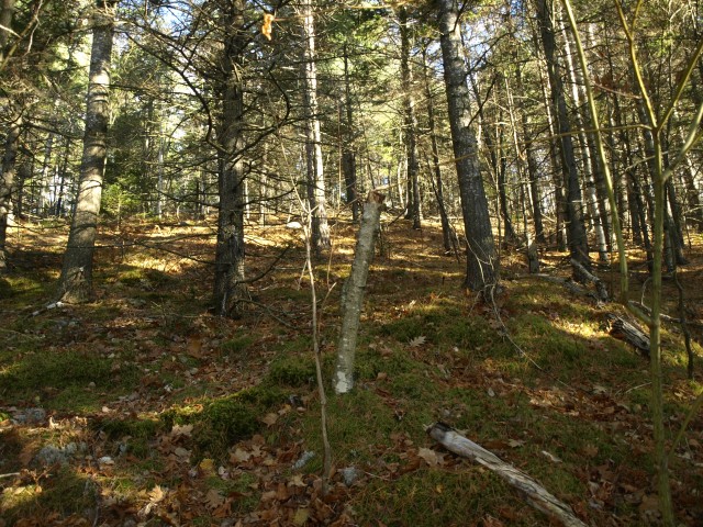
Pine Mountain, another beauty
Now it was off to Pine Mountain, the next summit along the ridge. It was quite a ways away, and even as the crow flies it was well over a mile. The other thought we had was that we needed to avoid a very deep basin between us and it, and to do that we would have to deviate from any straight line course of attack and follow its perimeter.
We dropped off of Kettle's summit to other viewing areas, and even more excellent views awaited us atop a small southern summit of the mountain. The descent from here was a tad steep and the mass expanse of the area was starting to set in. We didn’t want the extra distance of skirting the deep cut in the mountainside but we wanted the elevation change even less. We stayed atop the edge of the precipice in what we would describe as fields of gold, which were more clearly defined as wheat grass. The openness of the area was welcoming and even more importantly at this point, easy to travel through. We eventually reached the top of the abyss and simply hopped across the flowage, where a small wetland was above us.
We climbed the slopes of Pine Mountain to see what fortune was awaiting us there. The forest started out moderately easy and quite open as we passed through maples, beech and an occasional white birch tree, but this would only flirt with us as the summit was rimmed with some tight-knit spruce. The top came swiftly as we pushed harder and faster toward the red-pine-covered summit ahead.
The views were not quite as spectacular as Kettle Mountain but they were still worth a visit. With a closer look at Harris Rift Mountain, Black Mountain and Middle Mountain, we decided to hang around for a while and marinate in the views. Eventually we had to move on, so off to Forks Mountain we went. Forks Mountain was actually quite close to where we were standing, but we would need to descend a fair amount of elevation to reach its base.
Forks Mountain and the railroad
The descent as we followed the mellowed slopes of Pine came swift and the steeper portions even swifter. This peak is not as stately as the prior two, with its flanks barely cresting the tree line before us. We could see that we wouldn't have a time of it, but it was important to us to not only see what was up there but to access the railroad on the other side. The railroad tracks were imperative to an easy walk back to the car we spotted on the way in.
In some sort of violent exercise we broke through the thicker spruce waves and into the more open balsam stands. The summit was much more open and to our delight, the northeast slopes were as well. At this point we had just about chewed up our reserves of energy and wanted to just get down to the railroad tracks where we could walk upon a smooth surface. The shadows were getting longer and after only about 15 minutes of an anarchy descent we stumbled upon the old Delaware and Hudson Railroad line. Many of the railroads are being restored and I imagine this one is one of them. What gave it away? Well, the widening of the corridor for one. Some sort of machinery or maybe even a few loggers had come through and leveled about 10 feet of trees and bushes on either side of the tracks. Secondly, there is talk of Tahawus being accessed once again to remove tailings, which have apparently been awarded some sort of value.
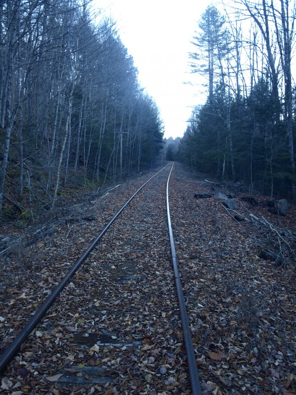
We only had about a half mile of railroad line to walk, which after the prior conditions would be a piece of cake even with the oddly spaced ties. Remnants of the old railroad line littered the sides of the tracks, provided an interesting walk through history and quickly brought us back to North Woods Club Road.
If you're looking for something to do after the hike, head to Schroon Lake for shopping, dining and more!