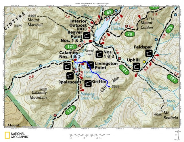
Cliff Mountain--A winter herd-path tradition
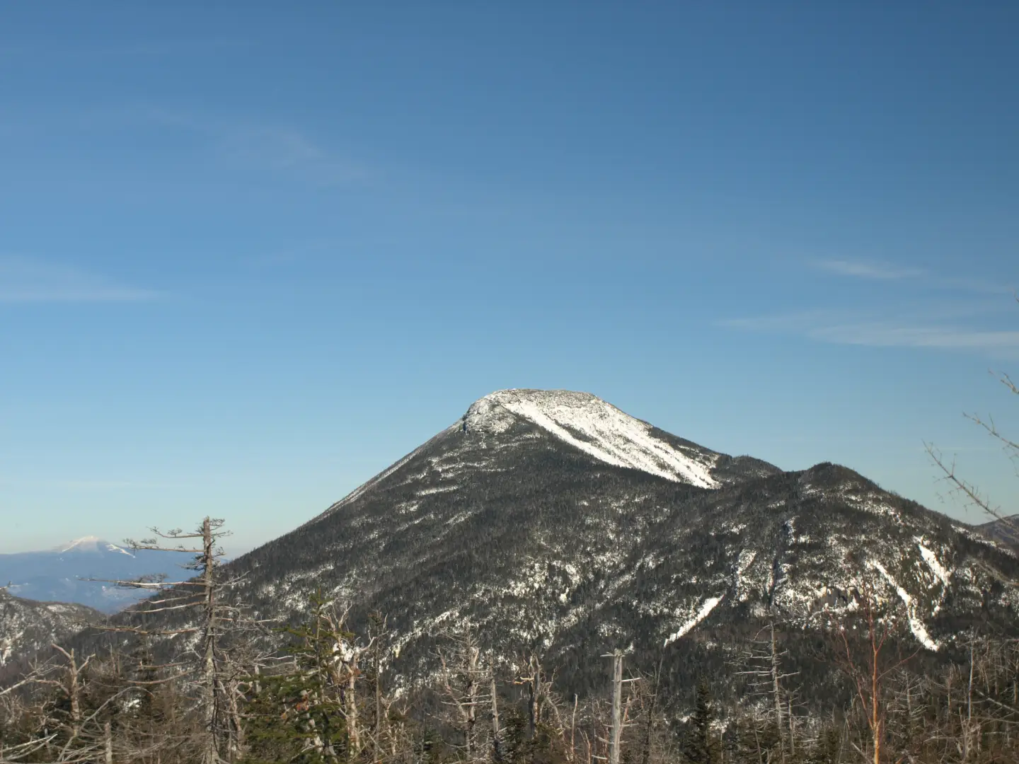
As many of you may know Cliff Mountain, standing at 3944’, is part of the Adirondack 46 High Peaks - but under current criteria that just doesn’t measure up. When the 46 High Peaks were originally measured for height, Cliff was surveyed at being over 4000’ in elevation, later to be revealed as not. Cliff Mountain still resides on the list, as it should, it was one of the original bunch and honestly it adds some good climbing to the mix. Located behind Mount Marcy, Cliff often shares its glory with Redfield, at least for those who want to bag two peaks in one day. Now, when it comes to winter climbing it often gets to be a standalone peak, because adding Redfield on the same day is more than many can bite off. With this being the case some clever winter mountaineers have developed a route, for winter use only, that will gain the climber the summit of Cliff directly from Flowed Lands. The route really hasn’t developed a name, per say, but I have heard it referred to as “Cliff Direct.” Most just call it “that bushwhack route from Flowed Lands.” While I wouldn’t call this a tradition for most, it has become a traditional winter route, for those who know about it.
Upper Works
To access this approach from the Schroon Lake Region it’s rather simple. But first and foremost it’s best if you can stay in the Schroon Lake Region the night prior, because a fresh early start is very important and Upper Works is a short drive away. Follow Blue Ridge Road out of North Hudson toward Newcomb. Just prior to reaching Route 28N in Newcomb, take a right onto Tahawus Road and follow this all the way to Upper Works Road, which will come in on the left. Follow Upper Works Road to its end at the High Peaks Trailhead.
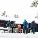
When we reached Upper Works on our last trip we felt pretty good, having stayed so close by the night before we avoided that long drawn out car ride at 3:30 am that we had dreaded even thinking about. We dressed lightly for the ride to avoid getting sweaty in the car and then getting an instant chill once we were out in the parking lot. We shared the trailhead parking with only two other cars, their hoods were well coated in a snow frosting, apparently they had been here for a few days. Now suiting up for the balmy 20 degree, 5:00 am start, we were pleased to not have to wear excessive layers to battle the cold that settled in only a few days ago. A light southwest wind was predicted to bring in near 40 degree temperatures by mid-day, not sure if this was going to be good or bad for snowshoeing – but I knew my digits would be happy.
We moved along the trail as though we were going to be late for last call. But in all honesty, the first portion of this trail along old wooded roads is a cake walk and a great way to gain distance and make some really good time doing it. We also didn’t even know if “Cliff Direct” had been broken out and developed for the season yet. If it wasn’t we would have one heck of a battle on the steep slopes to summit this day.
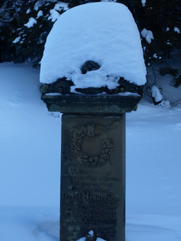
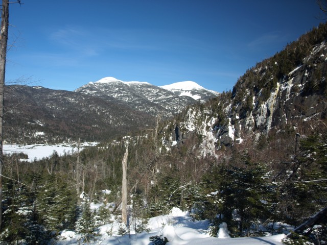
The trail to Flowed Lands was as hard as concrete, if it weren’t for the traction (and the lack of will to carry them on our back), we could have skipped the snowshoes. Flying by the Henderson Monument I started to get my mind rolling about a near future climb on Calamity Mountain, but that’s another story altogether. Soon we stood at Flowed Lands and were signing into the trail register. What’s this? Someone else was here a few days ago doing this exact route. However, we still didn’t know if they made it all the way or not. The wind was howling and not with that warm breeze we had hoped for. The wind not only battled us, but it also completely covered any sign of a trail over the frozen Flowed Lands. We had a rough idea of the location on the other side so we just angled for the peninsula named Livingston Point. Once we arrived at the lean-to on the point we tried to find any sign of a herd-path. Walking in circles and meandering around like a lost beavers we just decided to go for it. We couldn’t find any herd-path, maybe the other group gave up, or maybe it just wasn’t where we thought it should be. We had plenty of time to make our own route, it wasn’t quite 8:00 am yet. We dropped over the hill near the lean-to and down into drainage for Livingston Pond, then over a small rise to another lowland area and BINGO, there it was. The herd-path, sort of, I mean it was there for sure; faint from being blown over, but good enough to follow.
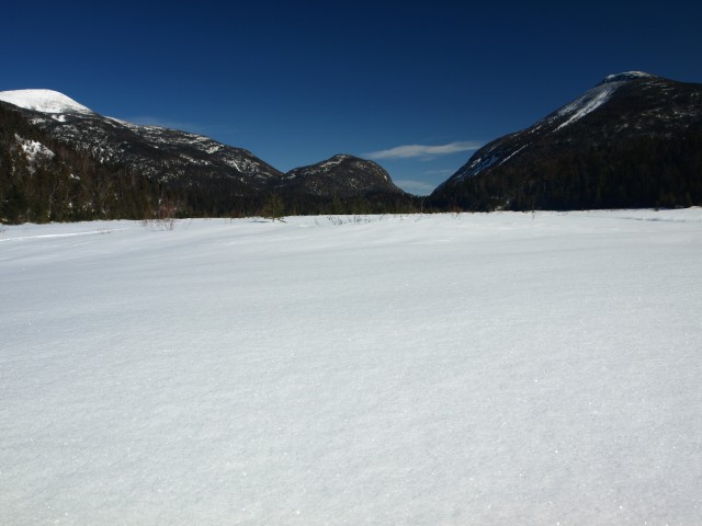
Flowed Lands to Cliff Mountain
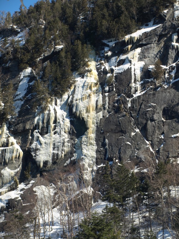
Now on the herd-path we could breathe easier, at least we had a direction of travel that might avoid the massive blowdown fields that were warned about on this side of the mountain. The path gained us elevation very fast and led us over to the main drainage that ran near some massive cliffs. The path never really advanced to the brook but stayed high and offered us almost instant gratification of views. The views just kept getting better as the summits of Iroquois and Algonquin started to pop out over the trees.
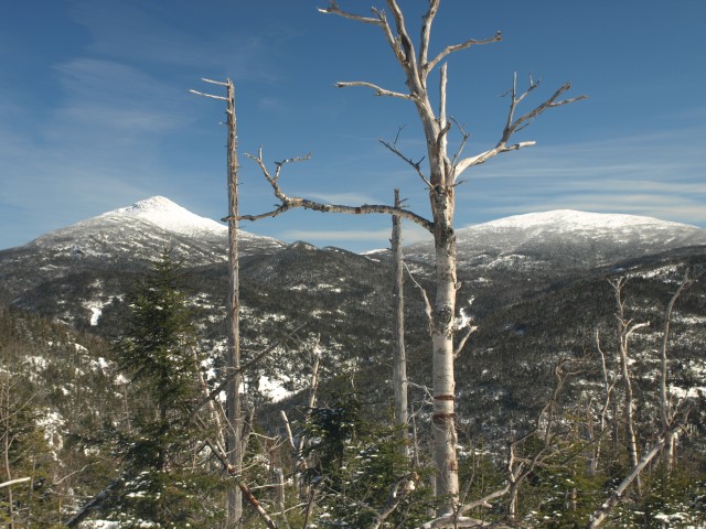
Soon we would be brought into the forest where the herd-path avoided most of the thick groups of balsam and spruce, although a few seemed to just push through. The herd-path, as you can imagine, was constructed of numerous small and large switchbacks to avoid minor cliffs and dense stands of conifers, but we were okay with that. The summit was literally right there looming in front of us. A short section of four-legged climbing was involved, but the traction was decent, we knew this would be the crown of the summit, and sure enough, shortly after, we were there. I must say, the views in winter are far more dramatic than the ones in the other seasons. The 4-feet of snow we were standing on sure does help lift you up over the spruce and standing snags. Wide open vistas, High Peaks right in your face, and the motivation to try for Redfield. Okay, I wouldn’t go that far, we really only wanted to climb Cliff, so we did an about-face and descended the herd-path back to Flowed Lands.
We were back at the trail register near Flowed Lands in right about an hour from leaving the summit. It’s not that we ran, we literally just slid off the mountain. The herd-path was now so well developed and steep that we could butt slide and glissade our way to the base of the peak in no time at all. The remaining 4-miles or so came a bit slower. We were so far ahead of schedule we just moseyed our way back to the car.
Taking my advice and staying over in the Schroon Lake Region? Book now online. Bet you’ll be hungry after the hike, or need a carb-loaded pasta dinner the night before, we also boast some great places to eat. Rather be guided to the summit in the High Peaks, maybe Cliff – our local guide services are here to oblige.