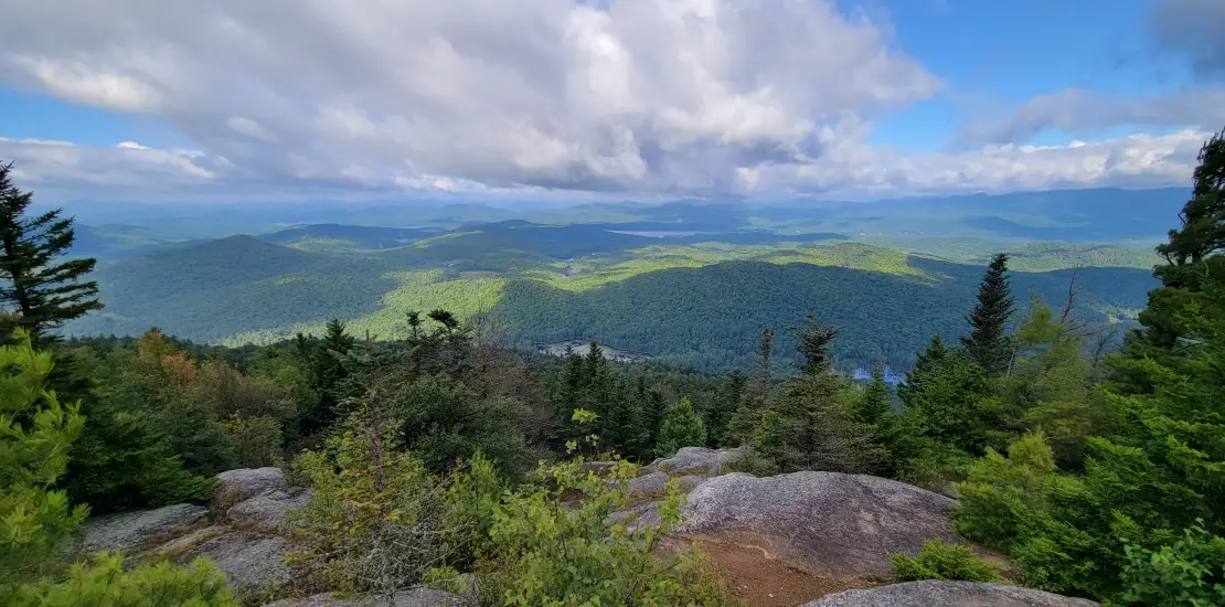
Hiking Pharaoh Mountain includes a nice long warm-up walk, before steeply ascending the tallest peak in the vast Pharaoh Lake Wilderness Area. Rewards include a near 360 degree view.
Key takeaways
- Distance: 9.1 miles round-trip
- Elevation gain: 1,920 feet
- Mountain elevation: 2,556 feet
- Hike includes trail junctions
Hiking to Pharaoh Mountain
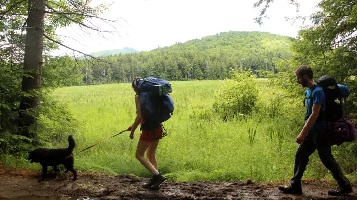
There are multiple ways to hike this mountain. With it being at the center of the entire Pharaoh Lake Wildernes Area, trails snake there way towards it. The hike from the southern trailhead is longer and tougher, but a worthwhile way to do it, and described in this story. The route described below is from Crane Pond, the most popular way to hike this peak.
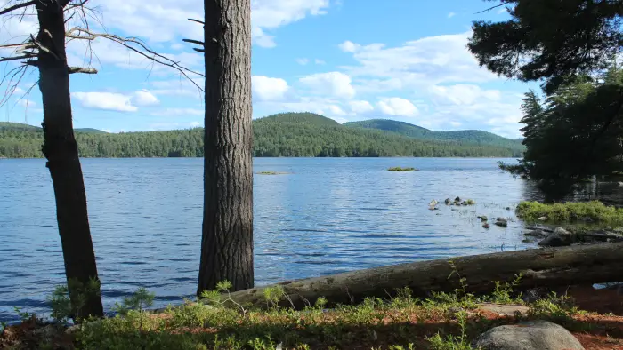
Walk the 4WD road for about a couple miles. At a little less than 1 mile in, you'll pass a trail junction for Goose Pond on your right. Continue straight, paralleling Alder Pond until you reach the old trailhead. Cross the bridge over the outlet and continue on a flat trail for 0.7 miles to a junction. Turn right, continuing passed Glidden Marsh, and eventually starting to gain elevation as you make your way up Pharaoh Mountain. At a little over 3.5 miles in, the trail starts to significantly steepen. You'll start getting some views, before eventually summitting the stunning mountain. Views to your east include Pharaoh Lake. Views to your west are expansive, and on nice days you can see the High Peaks.
Pharaoh Mountain in the winter
Skiing Crane Pond road would be enjoyable, but we recommend switching to snowshoes for the mountain ascent. This hike is done in the winter, but be aware that it is remote, and you may have to break trail. Be prepared for all winter conditions by planning ahead, having the right gear, and practicing Leave No Trace principles.
Find more trails in the Adirondack Hub
Does Pharaoh Mountain sound amazing, but a little more than you want to tackle right now? With the Adirondack Hub being at the center of so many trails, we’re sure to find the best hike for you!
How to get there
There are more access points for this mountain. Here is the one for the hike described above: Take Exit 28 off of I-87 and continue south on Route 9 to Alder Meadow Road. Turn left on Alder Meadow Rd. for 2.2 miles, then left on Crane Pond Rd. The road beyond is quite rough but still drivable with high clearance vehicles, but not recommended. Park here and walk the easy road to a flooded area with a trail bypass to the left that leads to Crane Pond, 2.0 miles from the parking area.