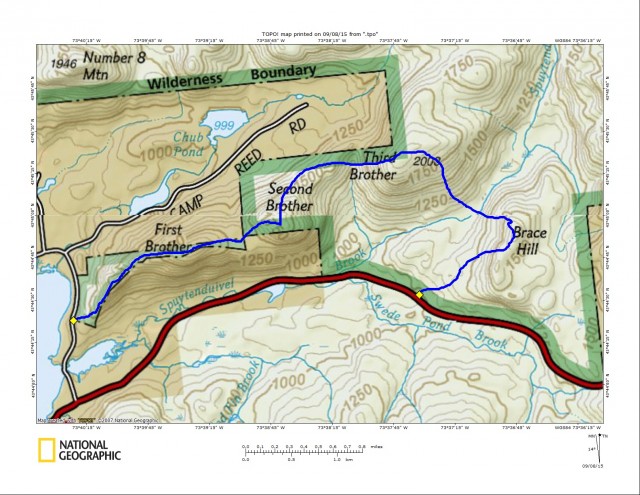
The Famous Brothers
The siblings are a Little Sister and Three Brothers, and even a first cousin would be thrown into the mix. The “who” that would be the favorite is in terms of views. You see I am not talking about a family rivalry here, but a set of five peaks all in a row that a buddy and I would explore in Brant Lake. Both Jim and I had read on several occasions about The Brothers and even seen a few pictures, this whet our whistle to get out there. We had flirted with the idea of making the drive down to Brant Lake just for this occasion, but more often than not we ended up doing something much closer to home, not involving a 2.5 hour drive (one-way I might add).
We weren’t sure exactly how long this adventure would take us, but we did get word that a decent path was developed up and over at least four of the mountains, Brace Mountain (the cousin) would surely be a bushwhack. With that in mind we passed on the “early bird gets the worm” idea and slept in a bit and settled on a later start of 9:00 am. You see there is no direct route to Brant Lake from home, for either of us, and coming in from opposite directions we couldn’t even carpool. Even if we could have, we had planned a traverse where two cars would be an essential part of our day.
We met up at the state boat launch site on Brant Lake and Jim followed me to a parking area off Route 8. The parking area sets at the base of Brace Mountain, which was our final peak planned, and Route 8 was where we would emerge from the woods. We then piled into one car and drove over to Palisades Road where a small finger of state land would access us the mountains. We found the paint blazes on the trees and what appeared to be the herd path. With room for only one or two cars along the shoulder of the road I managed to get the entire vehicle off the road - and being parked on a sharp corner that was important.
Heading up Little Sister
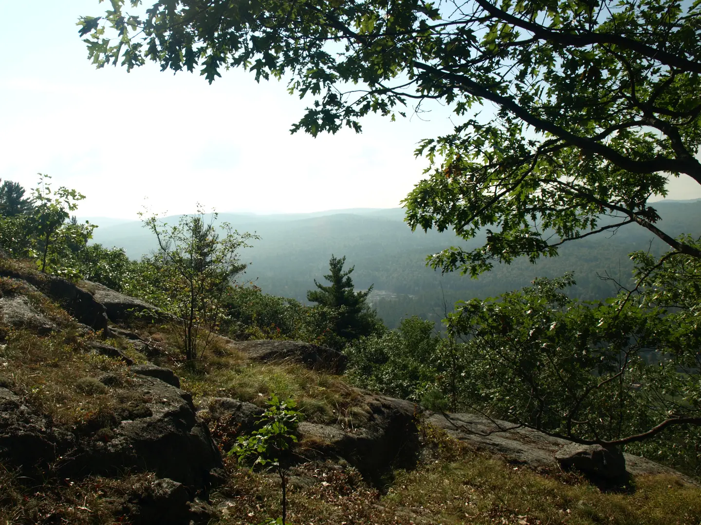
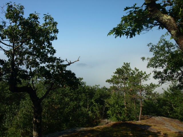
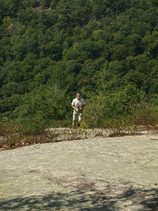
The trail started climbing right out of the gate as the flagged herd path followed the state property line. It was steeply graded but quickly leveled out once we hit the ridge. We got slightly off track as the path split away from the state property line, and we ended up having to back-track a little bit because we missed that separation. Once we were on it again, we had no trouble following it to the summit of Little Sister. Little Sister isn’t an official name for the smaller summit along the ridge but Barbara McMartin referred to it as “possibly the Little Sister,” so we just went with it. We were still slightly in the morning clouds but the lingering ones were burning off fast. In fact, as we waited, we could start seeing the mountains behind Brant Lake starting to peek through; it was quite majestic. From here we stayed atop the ridge on another faint path, also flagged, but much more difficult to follow.
Now off to the First Brother
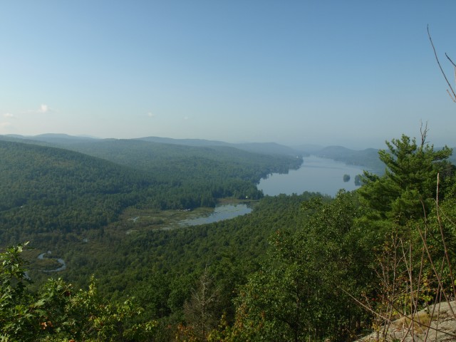
We made a heading right at the First Brother which set at around 1650’ in elevation. As we progressed over the ridge the open rock started to appear and we had amazing views out over Little Sister to Brant Lake beyond. The clouds have now burned off and we had hazy views for miles. If was kind of like looking through a glass of skim milk. It was getting very hot, and as the saying goes “it’s not the heat but the humidity,” I can vouch for that.
We stayed right as to not miss additional views, but quickly the path started to disappear and we wanted to get back on it. The First Brother was layered in sweet fern; the pungent smell overtook our senses as we pushed through its entwined branches. We eventually came back to the trail as it led us close to the summit of the First Brother, but of course we needed to tag the wooded top.
The Second Brother awaits
The trail now descended before us - not all that steep, but very slippery in spots as the oak leaves made for a natural slip and slide. One instance of a slanted rock shelf got the best of me and my awkward flailing to catch myself ended up in a twisted heap at the base. Luckily all that was injured was my palm on my left hand which received a slight case of road rash, or trail rash might be a more appropriate title. Slightly bleeding, I knew I would have fun holding my trekking pole for the remainder of the trip but I just rubbed some dirt on it and dealt with the inconvenience.
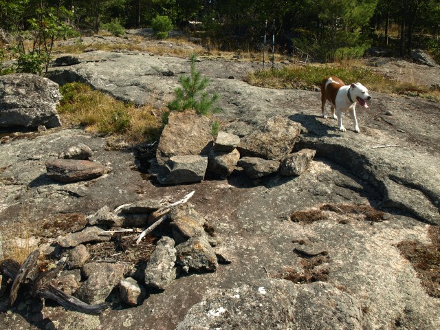
Soon we stood at the base of what appeared to be a fine view, but we needed to get there first. The slopes were crazy steep, which we didn’t have to use, but good fun is in a wilderness scramble. The oak leaves again caused a bit of concern as they spread out over some unstable moss, but with carefully chosen foot placement we worked our way up on all fours. We rested atop a stellar viewing area at a makeshift camp created from local stones. Two chairs and a fire pit were erected from slabs of free rock, a nice conclusion to a steep climb on a humid day. We sucked down another bottle of water before we pressed on to the wooded summit of the Second Brother.
The Third Brother stands tall at just under 2000-feet
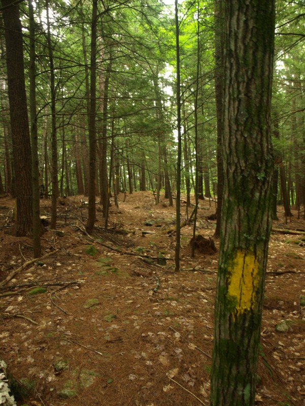
The herd path blazed in red dots was making us uncertain of its destination and since we had not been here before we didn’t know what to think. Too many times bushwhacking we had followed blazed trails only to be led off the wrong side of the mountain. We didn’t want that to happen. We followed for a ways but it seemed to veer off to far left and drop off the ridge and not head toward the Third Brother. We opted to bail on the herd path and head right for our destination atop the fourth sibling.
We managed somehow to get pulled off the ridge and had to climb our way back up, and atop the ridge we found that red dot trail again, I guess it did go in that direction after all. We followed it as is it led us over the ridge with great views of the Third Brother. We could see the open rock on this side of the mountain and it was imperative that we find it. We were quite sure that the red dot trail would head right up the gentler slopes of the ridge and not approach the steep open rock. We stepped back into hardwood forest and headed right up the steep face of the mountain. The jumbles of rocks and odd footing pushed us back left and as we neared the base of the open rock we ended back up on the red dot trail again, we just couldn’t win.
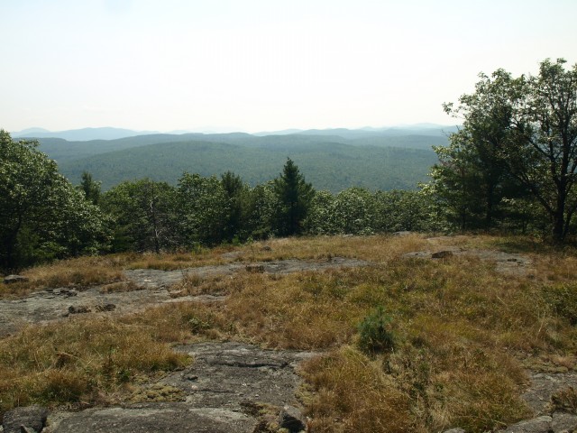
The red dot trail actually brought us right to the open rock and directly up it. Taking in the countless views we slowly made our way up to a large open field of rock and sedge where views off to the east were just as fine. The summit once again was wooded but the views we had along the way made that so much less important.
Bracing ourselves for the final peak
As we approached the end of our day we had one mountain left before we could descend directly to the car, and that was Brace Mountain. We had no idea what Brace would offer us, possibly nothing more than a nice walk in the woods. The descent was easy as we passed over open rock and through open hardwoods and quickly we stood at the shore of Spuytendulvel Brook, yes that’s how it is spelled, not exactly sure how to pronounce it though; I guess it’s a good thing I am writing and not reading. This brook is a massive width of rocks and boulders. Well over 12-feet wide but only a trickle was flowing through it. Our maps showed a wetland about 0.2 miles upstream and our love of ponds and wetlands drove us to check it out.
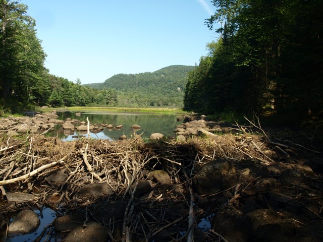
We rock-hopped the 0.2 miles and found ourselves at a wonderful location with outstanding vistas out over the beaver swamp. A few pictures were in order and then we would climb the steep slopes of Brace that came right down to the shore. The climb was all we could bear at the end of the day. Tired and overheated we pressed on ever so slowly to the summit of the wooded peak. Part of me wanted to check out the lower summit of the mountain, but a larger part of me just wanted to get back to the car to get a cool breeze flowing over my face.
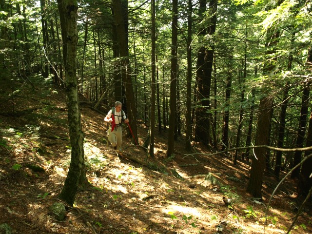
We descended in a quick fashion, side-hilling the super steep slopes, playing amongst boulder jumbles, hanging from partially decayed trees, and jumping from lip to lip. And, we made it to the valley below with only one mere slip and tumble. From the valley we had a relaxing walk in the woods as we finished off the remaining half a mile to the car.
It was now time to head back into Schroon Lake, an important stop for an ice cream cone and a much needed ice cold drink. The remaining water in my pack was close to that of bath water and that, my friend, was just not acceptable.