Hiking New York's 25th tallest peak
Mount Marshall is the 25th tallest of the Adirondack High Peaks. It is a steep, serious hike that requires significant preparation and navigational skill. A successful hike of Mount Marshall involves research, physical fitness, the right gear, and knowledge of Leave No Trace principles.
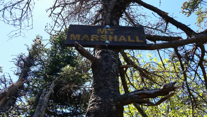
Marshall was named to honor Robert Marshall who, with his brother George, is one of the original ADK 46ers.
Key takeaways
- Distance: 13 miles round trip
- Elevation: 4,360 feet
- Elevation gain: 2,515 feet
- Hike involves unmarked trails, water crossings, and trail junctions
- Based on a hike from the Upper Works trailhead
Hiking Marshall from Upper Works
There are two herd paths that lead to the summit of Mount Marshall, the route below describes a hike of Marshall via the Herbert Brook herd path from Upper Works. There is also the option of hiking Marshall via the Adirondack Loj, which is a longer hike with more elevation gain. Please be aware that for most of this hike you will be on a marked trail, but the final ascent to the summit will be on an unmarked path. There are many worn paths around Marshall; it's critical you know which one to follow, and do your research before you go.
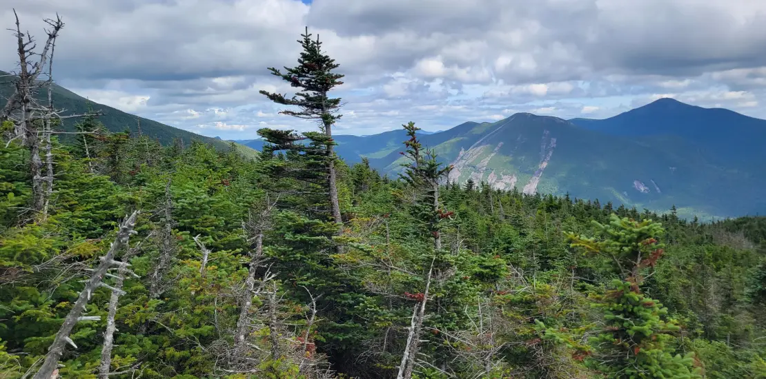
From the Upper Works parking area and historic MacNaughton Cottage, follow a long and somewhat flat approach which initially starts along an old woods road. As the route narrows back to a foot trail you will follow along some attractive waterways and eventually climb modestly to the shore of Flowed Lands. From Flowed Lands you will hike its perimeter along a difficult trail to the herd-path along Herbert Brook; a cairn marks the herd-path on your left after crossing a small stream. The route is now much narrower and follows along the brook to your left. The terrain starts out moderate with a couple steep ascent sections, and soon you will be crossing the brook several times. Once the herd-path leaves the brook, the terrain steepens. There is one excellent viewing area along the summit ridge before you reach the treed summit to your left.
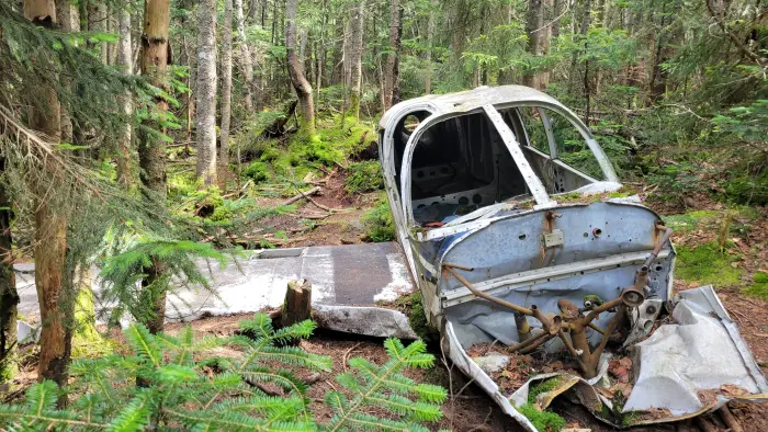
*Another way to reach Mount Marshall from the Adirondack Loj is via Cold Brook Pass.If you are interested in taking this route, particularly to view the historic plane wreckage, do your research and consult with the experienced staff at the High Peaks Information Center.
Marshall in the winter
Mount Marshall is a challenging mountain that should only be attempted by experienced hikers, especially in winter, so make sure you are prepared. Snowshoes are necessary, and snow spikes are needed to climb the upper reaches of the peak and around the icy sections by the brook. Plan on temperatures in the higher elevations being at least 20 degrees colder than at the trailhead, not including the windchill. Bring several extra non-cotton layers, a headlamp with spare batteries, extra food, a windbreaker, goggles, a face mask, and supplies for spending the night in case of an emergency. You will cross Herbert Brook several times. These crossings can be especially dangerous during the beginning and end of winter. Always use caution at water crossings. Turning around is always an option.
Find more trails in the Adirondack Hub
Does Marshall sound amazing, but a little more than you want to tackle right now? With the Adirondack Hub being at the center of so many trails, we’re sure to find the best hike for you!
How to get there
From exit 29 off I-87, turn west onto Blue Ridge Road (CR 84) toward Newcomb. Follow this route for 17.4 miles to an intersection with Tahawus Road (CR 25). Turn right on Tahawus Road and stay on it for 6.3 miles then turn left at a sign for High Peaks trails. Pass by the old blast furnace at 2.8 miles up this road. From the blast furnace, it is less than one mile to your destination. The road dead ends at the Upper Works parking lot. From here, you can follow the marked trail to Flowed Lands, eventually picking up the herd path to Mount Marshall.