View in seclusion, the Hoffman Notch Wilderness
Jimbo and I had a plan. Well, I had a plan, and Jim was all about coming along for the ride. I have driven by the North Hudson exit off I-87 probably a hundred times now, and over the course of those passings I always feast my eyes on this one particular peak that rests over the top of Palmer Pond. I had always assumed it was Squaw Mountain from a quick look on my topo maps, until the one day I really did some research and found that it really doesn’t have an official name and Squaw Mountain was a small peak just south of it. So, I decided to call it Palmer Pond Mountain for a lack of a better name - who knows? Locals may have a different name already in place, I would be curious to know. It appeared to have some nice rock ledges worthy of a visit.
Now back to our plan. We would start at the Dirgylot Trailhead off Route 9 north of Schroon Lake. This would be our access point to pass over Wyman Hill, Squaw Mountain, and then Palmer Pond Mountain before descending down to Palmer Pond and meeting a second car, making for an epic 8-mile or so traverse in the Hoffman Notch Wilderness. Seemed simple enough on paper, but boy was it going to be hot and humid! The humidity and the heat were almost an identical match at 80 degrees and 85% humidity. It was going to be a sauna of sorts by noon.
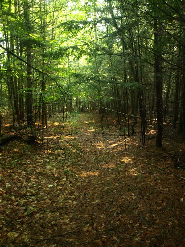
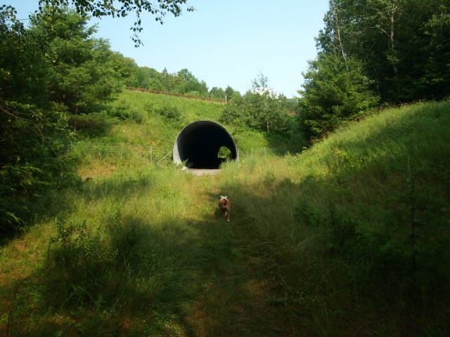
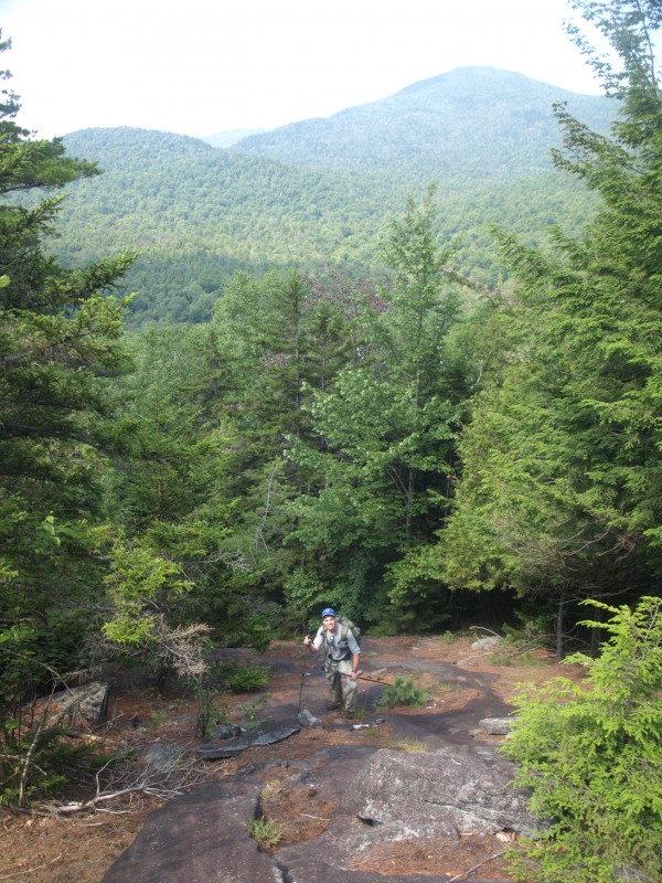
After meeting up at the old Frontier Town parking lot, we first spotted a car at Palmer Pond just up the road, and then carpooled the few miles over to the Dirgylot Trailhead. This is an old trail, but the DEC Trailhead is rather new. The trail soon brought us to a car width passage through a culvert under I-87 which directs adventurists into the Hoffman Notch Wilderness. On the opposite side the trail remains very wide, almost like an old road, which it very well may have been considering the size of the culvert we just passed through. Climbing immediately up over a shoulder of Dirgylot Hill on our left we were happy to be on a trail, as we knew it most likely wouldn’t last long. From a previous adventure in this area I recalled that the trail split about a half-mile or so from the culvert (of course it was so long ago, it easily could have been another spot, but sure enough, there was the splitting). The split was more like a T-intersection, left goes behind Dirgylot Hill and Smith Hill. Right headed in the direction we wanted, more of a northerly direction right toward Wyman Hill.
Wyman Hill
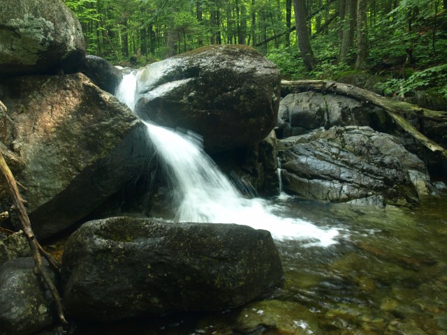
This secondary, unmarked trail went on and on and on, from a wide ATV-sized trail to a narrow path, to a wider foot trail and back to what looked like an old road. Overall it was in fantastic condition and only a couple spots required us to hop over a downed tree - this was a gift for sure. As the heat started to bring our internal body temperature to a slow rolling boil, the humidity coated our skin and caused me to start steaming from beneath my pack, a sight I am used to seeing, but generally in the winter where the air temperature is much cooler. We took a short break next to a small waterfall where we splashed a bit of water on our faces, and powered up to finish off our approach to Wyman Hill.
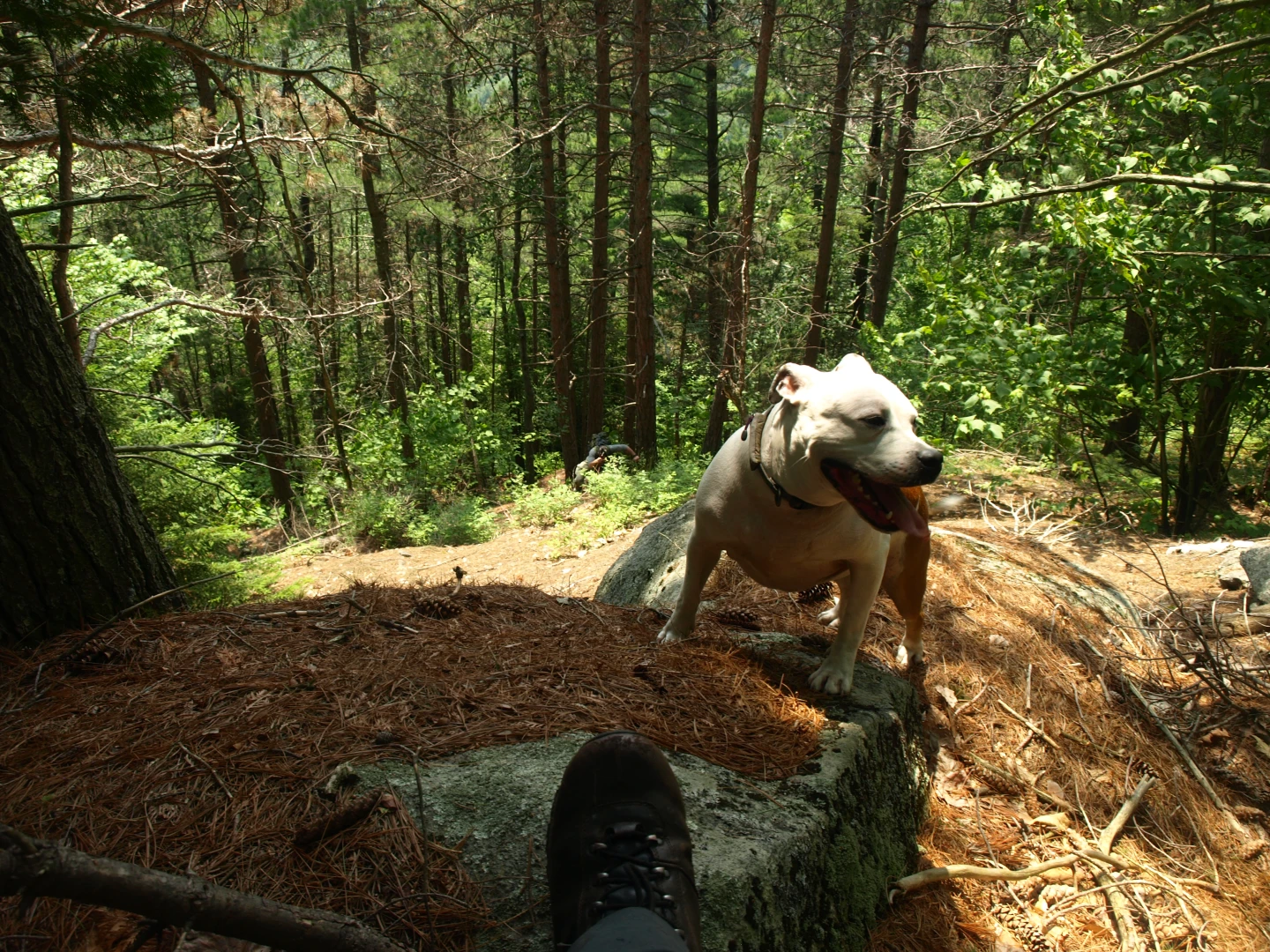
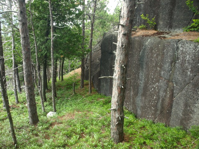
The old road that we were on continued, but as it swung further away from Wyman and closer to the Peaked Hills, we decided it was time to start a bit of cross-country travel. The route toward Wyman was an easy bit of traveling. The forest was open and the brook crossings were a piece of cake. Finally at the base of the peak we could start to do some serious climbing, and by serious I mean wicked steep! We came to the base of a long, very high angled rock slab - closely resembling a rock slide without the debris of downed trees at the base. It could have been a really old one, but I think it was just too steep to support life; hopefully it would support ours. The rock was “sticky” as climbers call it - which is just a term for rough rock with enough features for your rubber soles to grip. As we progressed we started to get some of the finest views I have ever had of Hoffman Mountain, Blue Ridge, and the Peaked Hills. We sat atop the rocks to take in our find. The summit wasn’t far from here and it took us only a few more minutes to find it, although other small viewing areas delayed the quest. The summit was open rock but the surrounding trees blocked potential views. We were now off to Squaw Mountain, a peak smaller than the hill we were on - odd how something gets credited as being a mountain and others not. The descent was thick and scratchy but quick. The climb was almost non-existent at only about 130 feet of gain. The summit was not much to write about; wooded and viewless, buggy and muggy, we moved on.
Palmer Pond Mountain
The descent off Squaw was a bit more than the climb, but again it didn’t take long to reach the base of Palmer Pond Mountain. A nice brook ran through the pass, giving Abby a nice drink, and saving our water supply, that we would so desperately need a bit later. We would now climb up the steep slopes of the mountain in what would be 900’ in under 0.4 miles. The climate was now reaching nearly unbearable temperatures and the exhaustion of the steep climb with temperatures in the 80s was wearing on us. We were sure at some point we suffered from heat exhaustion. Even with plenty of fluids in our system we ended up getting a bit nauseous and light-headed as we climbed, and I am sure it wasn’t elevation sickness. The closest way out was to go up and over to the other car, so we just went very slowly and inched our way higher and higher. Hand over fist - on all fours at times - we pulled our way up with aid of trees and roots.
Open rock and small ledges hindered fast travel, but opened up the forest to small pockets of cool breezes that gave us moments of relief and a bit of a mental vacation to help us continue. Finally at the base of the summit cliff we could stand on flat ground and ponder how we would get around its massive expanse of granite. A shelf would give us route around and up top of the rocky summit. The breeze was a treat, cooling our flesh and drying our clothes. We were almost instantly refreshed, yet in the same token we were drained. The views were astounding, none so spectacular have we found in quite some time; we could live here.
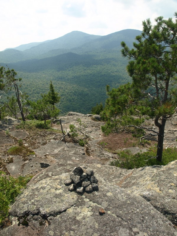
Our residence atop this mountain lasted about 30 minutes until we could get our feet back under us in a more stable form than the Jello-knees we currently had. Cairns marked the summit, showing that this unnamed beauty of the wilderness gets some visitors from time to time. Soon we had to leave; we still had over 1.5 miles to get back to the car which, depending on the terrain, could venture closer to two. We descended slowly as we still felt weak and my water supply was dwindling. Jim offered up some Gatorade, which I knew I may have to take him up on later. We were descending now at a rapid rate, and on the descent my need for water was much less apparent, but my need for salt was not. We rested a bit longer so I could eat some salty almonds I had in my snack bag - which I think gave me a bit more of the electrolytes my body needed - Abby and I finished off the water.
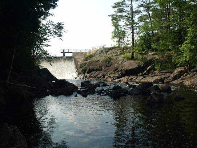
Two small ridges blocked us from the car. So, while unwanted, we needed to climb over them to gain the slopes we desired to reach Palmer Pond far below. We soon hit the state-property line which was still a bit above the pond but followed the side of the final ridge which would bring us down to the edge of I-87 where we would have to cross The Branch at the base of the dam on Palmer Pond. There was no way we would cross this outlet without falling in or wading up to our waist, so we opted for plan B, which was not a favorite of mine, nor one I looked forward to. We needed to walk about 100 feet down I-87 across the bridge, and with a dog, this would not be fun. Jim carried my trekking poles and I hoisted Abby up into my arms, which is easier said than done with a 60-pound wiggle hound. I ran as best I could as she began to slip, it must have been a sight for those driving by. We made it to the other side and onto the grassy shoulder of the entrance ramp with no issues, but it surely was not something I wanted to do again anytime soon. Back at the car we finally stood, exhausted, dripping in sweat and coated in a fine layer of dirt and balsam needles. The car was baking at close to 100 degrees inside; we couldn’t wait for the cool breeze to clean the funk and nature from our bodies.
Parched and ravaged I couldn’t wait to get something in my stomach; a quick stop at Stewarts in Schroon Lake on the way home was just the ticket. Want to learn more about the Hoffman Notch Wilderness? There’s plenty to explore - and many treks that are super user-friendly for those of you that would prefer not to bushwhack! You should hang out in Schroon Lake for a few days and visit the Pharaoh Mountain Wilderness Area as well, trust me you won’t be disappointed.