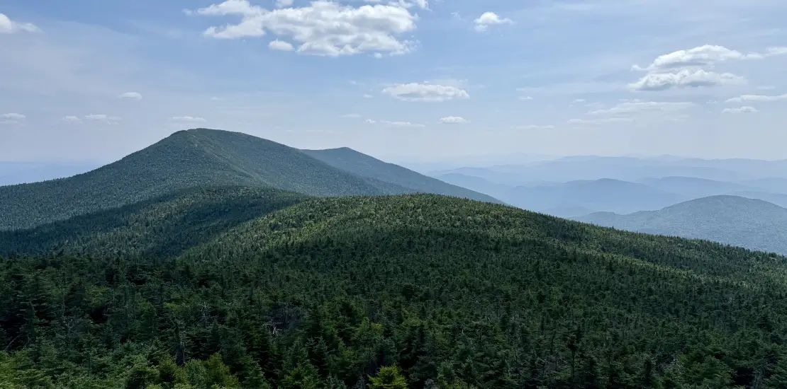
Santanoni, Panther, and Couchsachraga
These three peaks are the some of the more remote and difficult in the High Peaks. No official trails lead to these 46er summits; it's all herd paths. The three mountains are: Couchsachraga, (46th highest at 3820 ft.), Panther Peak, (18th highest at 4442 ft.), and Santanoni Peak (14th highest at 4607 ft.). Technically, Couchsachraga is not one of the 46 highest peaks in NY, because it is under the 4000 foot requirement, but due to an early measuring mistake, it is still required to do to become a 46er. A successful hike of the Santanoni Range involves research, physical fitness, the right gear, and knowledge of Leave No Trace principles.
Key takeaways
- Distance: 15.1 miles round trip
- Elevation gain: 4,700 feet
- Hike includes bridges, trail junctions, unmarked trail, exposed summits, steep & loose rock, and water crossings
- Based on a loop hike of the range, going up the Express trail on Santanoni and down to Bradley Pond after hiking the other two summits
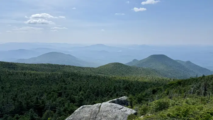
Hiking the Santanoni Range
Keep in mind that this is a description of doing the entire range at once. Many decide to leave out one or two, depending on conditions. Please do not hesitate to turn around, the mountains will always be there. It's a challenging hike over rugged terrain, but with spectacular views.
From the parking area this route follows an old gravel road. After 1.8 miles, a sharp and somewhat obscure right leads you along a foot trail. You'll encounter some foot bridges soon after. Be very careful, these wooden bridges can be slippery and quite high off the ground. At 3.4 miles from the parking area, the trail comes close to the brook and some beautiful cascades. Just beyond the trail flattens out and there is a cairn at the end of the flat area marking the spot where the herd path up the Express Trail to Santanoni begins on the left. A tiny way in there is a crossing of Santanoni Brook which can be complicated in wet weather. From here it gets a bit steeper, and then very steep over eroded terrain. As you ascend higher, the steeper it seems to get and more eroded under foot. You will pop out on the ridge just north of the summit of Santanoni at a T-intersection. Path right leads to Times Square and Panther Peak, path left leads left a short ways to the summit of Santanoni.
After leaving Santanoni, continue north on the ridge and you'll arrive at Times Square, a name for the intersection with the herd path to Couchsachraga, at about 6 miles into your hike. Turning left on the Couchsachraga path, follow the herd path that consistently descends for quite some time to a shallow col. The descent isn’t too steep, but it is long and you will lose a bunch of elevation that you will need to climb to get back to Times Square. In the col is a notoriously wet area, be careful here. The climb on the opposite side is mellow up to the final pitch that is steep and short. Once on the summit (7.5 miles into your hike), you'll have to turn around and retrace your steps back to Times Square.
Once back at Times Square, continue down the herd path to Herald Square. This is where the trail to Panther Peak branches off left. The views from Panther Peak are stunning. From Herald Square, the trail to Panther goes for 0.3 miles to Panther's summit.
From Panther, hikers can descend steeply towards Bradley Pond over a boulder-strewn trail. You'll reach a T-intersection. Left leads to the lean-to, right leads you back to the parking area. Camping is available in the lean-to at Bradley Pond on a first come, first serve basis. Camping between 3,500 feet and 4,000 feet is limited to designated campsites. A herd path will bring you just over a mile from where the Express branched off the main trail. From here, it's a long walk back to the car
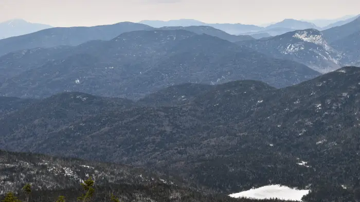
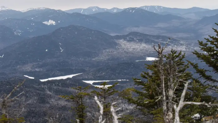
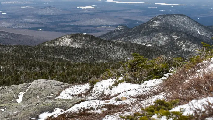
In the winter
The Santanoni Range is a challenging range that should only be attempted by experienced hikers, especially in winter, so make sure you are prepared. Snowshoes are necessary, and microspikes or crampons are needed to climb some of the exposed sections of these peaks. Plan on temperatures in the higher elevations being at least 20 degrees colder than at the trailhead, not including the windchill. Bring several extra non-cotton layers, a headlamp with spare batteries, extra food, a windbreaker, goggles, a face mask, and supplies for spending the night in case of an emergency. There are water crossings on this range, and the crossing over Santanoni Brook towards the Express Trail can be difficult in bad conditions. These crossings can be especially dangerous during the beginning and end of winter. Expect to be breaking trail the entire way.
Find more trails in the Adirondack Hub
Does the Santanoni Range sound amazing, but a little more than you want to tackle right now? With the Adirondack Hub being at the center of so many trails, we’re sure to find the best hike for you!
How to get there
From I-87, take exit 29 and follow the Blue Ridge Road (CR84) toward Newcomb. Continue for roughly 18-miles to the Tahawus Road (CR25) on the right. Follow this road 6.3 miles to a left marked by a sign for Mt. Marcy and the High Peaks. At 2.0 miles from this junction there is a parking lot on the left for the Santanoni Range.