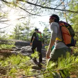
Jim and I were in search of an abandoned road, a deep valley, and a summit — not necessarily in that order. This was sure to be an adventure. It was the first week of September and strangely the weather resembled that of a typical July day, thick in humidity and boasting a rising heat index. There was hardly a cloud in the sky to offer us a reprieve from the rays of the sun, but fortunately we got an early start and the canopy of the maple and beech trees shaded us.
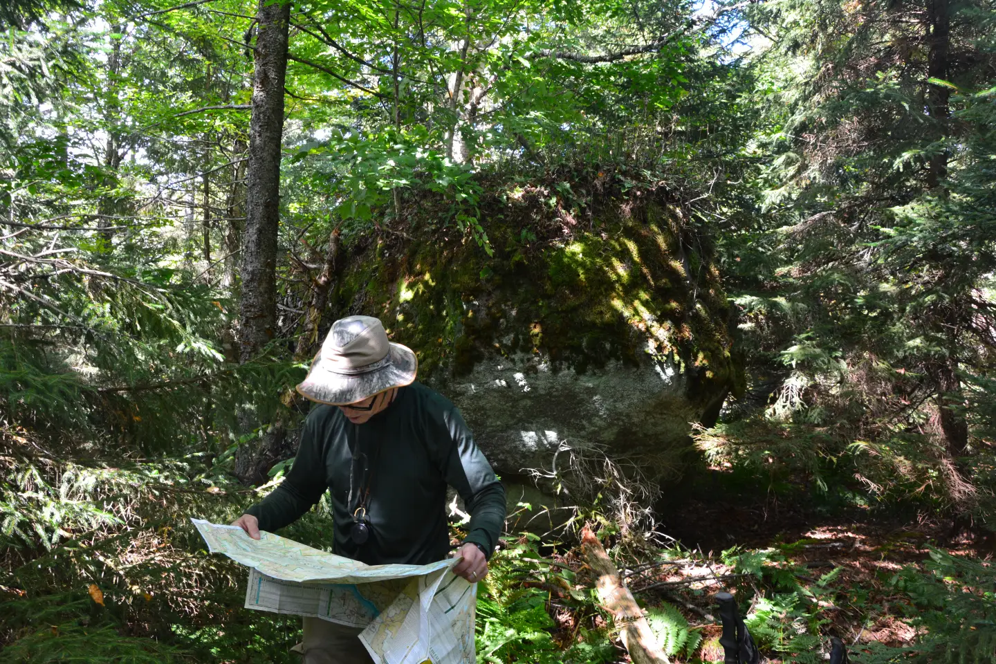
I had received a bit of beta from a friend in regards to Bailey Hill, the summit we were in search of. It supposedly had a large glacial erratic on the summit, which was essentially the highest point, and we would need to somehow scale it — but just how big was it, or was it just another “big fish” story? I had a notion to bring a length of rope to help aid our final ascent onto the boulder, but through a rush to get rolling in the morning I failed to act on it.
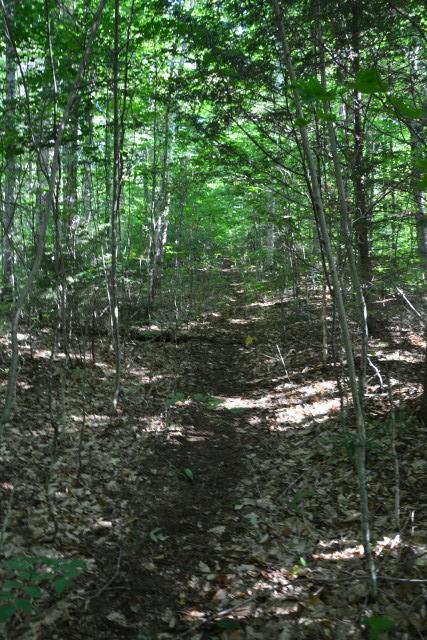
We arrived at the Loch Muller Trailhead for Hoffman Notch and Bailey Pond ready to hit the trail. We used the trail toward Bailey Pond which according to my USGS map is considered to be a continuation of Loch Muller Road. This old road, now well forgotten and abandoned, went through the valley east of Bailey Hill and ended near the base of a small bump on Washburn Ridge. Washburn Ridge is a rather large expanse of land spreading from Loch Muller to Blue Ridge, a land mass of curiosity for me.
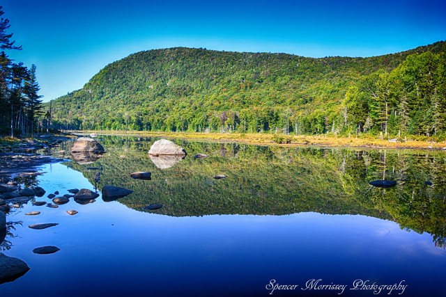
The trail to Bailey Pond moved by swiftly before us and of course we had to walk the extra couple-hundred feet to the shore to take a gander at it. The dry weather has definitely taken its toll on the pond, but its beauty still remained; Hayes Mountain reflected in the placid water like a sentinel to the area, watching guard, protecting its smaller brethren.
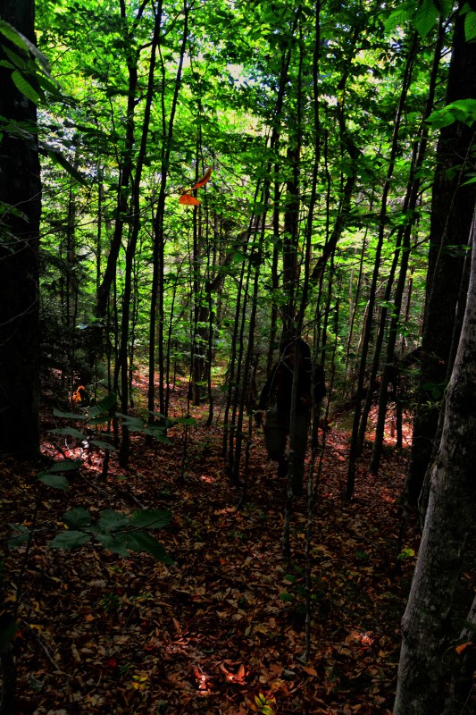
Loch Muller Road continued beyond the trail to Bailey Pond — we would use this as long as we could to gain the ridge on the south side of Bailey Hill. To clarify, this 'hill' is noted as 3050-feet — perhaps hill isn't quite an accurate term. The road remained well-used along the old trail toward Marion Pond, but as soon at swung left out of the valley, it pretty much disappeared into the forest, as did we. From this point we started our bushwhack toward the boulder-topped summit. The forest was open with hardwoods, beech nuts littered the ground, black bears would surely soon follow. High in fat, the beech nuts are a main source for these bruins to get ready for their winter hiatus.
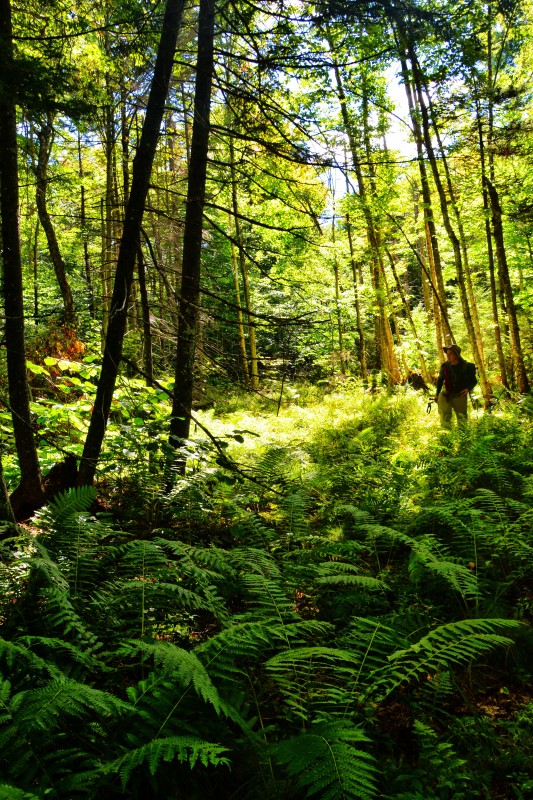
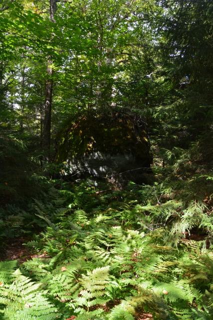
Once on the ridge the contour lines spread out and offered us a relaxing hike. Dotted with fern glades, small rocky outcroppings, and only a scattering of conifers we enjoyed nearly every step of the adventure. The ridge unfolded in front of us and we quickly neared the top. The highest point of land was just prior to the erratic, but the “pet rock” was obviously much higher.
The scramble to the top was an interesting proposition, one worthy of a short video, but lucky for us no one was watching. The boulder stood 12-feet in height and was massive in girth. It was well-rounded, and even if there were foot-holds and hand-jams we would have been battling the slippery and loose moss it was layered in. We decided it would be in our best interest to not climb it — but that wasn’t going to happen. We went in search of a couple of dead trees to prop up against a live one to use an impromptu ladder. We found two, both of which were, what I would call, “a piss-poor idea.” These two were rotten and not all that stable; I went in search of a third tree. Then I heard: “That wasn’t too bad,” as Jimbo managed to climb his small stature to the top using the other two. Weighing a good 75-pounds more than him, it would be questionable for me to use the same route. What the heck, I would give it a go. At about 5-feet off the ground I was able to reach up and grab a small pole-sized yellow birch and I pulled myself to victory. But now, how the heck would we get down?
Luckily, gravity did all the work getting us down. All we had to do was point our toes in the right direction and land flat and sound. Bracing our backs against the boulder we slid and landed on the soft spruce needle and moss-layered ground, with a small thump we were there.
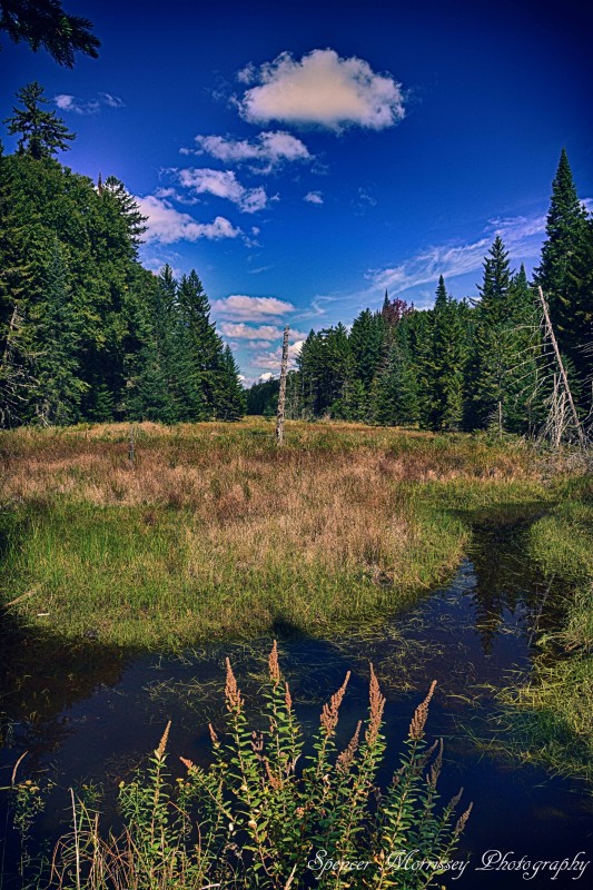
Located to the east of us was Bailey Pond Inlet and a small high mountain beaver pond, at least that’s what the map and our GPS showed. We were not all that confident that it still existed in the sense that water would still be left in the bowl. Would it be more in line with a grassy field tucked into a deep valley between us on Bailey Hill and the lower flanks of Washburn Ridge? Of course, we must go, because a close second to a mountain’s summit is a valley’s wetland.
Nature is full of genius and the fact that this secluded peak was so welcoming and the others around it are so violent, just solidified this belief. Our descent into the valley was steep, but broken up with land shelves allowing us a gentle conclusion to the mountain. A short distance from the summit we stood on the shore of the hidden wetland, looking out over a grassy layer with a marshy bottom. Too marshy for us to wander out further than 20’ or so in search of the perfect picture and soggy feet.
It was unfortunate that we couldn’t use the grassy field as an escape down through the valley; we would have to climb slightly back into the hardwoods and out of the conifer -lined shore to make any decent time at all. The undulating hills gained us much more unforeseen elevation and the chin hobble added a bit of frustration. We soon came upon an old beaver dam, one which must have blown out with age and drained the once gleaming pond that existed here. Downstream of the beaver dam was more grass and another dam, but the bottom was dry and offered an easy stroll further downstream where the wetland receded and the inlet’s rocky bottom reared its trail-like face.
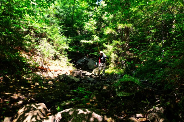
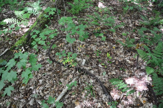
This was also roughly the area where the Loch Muller Road made a hard turn up Washburn Ridge and the spot we hoped to find it; however it was, like all roads and trails whose use goes unwarranted, returned to nature. We turned to Bailey Pond Inlet and the rocky trail it provided us as a clear route back to the trailhead, and we rock-hopped our way downstream. We made excellent time, slipping now and again on the moisture coated rocks, but we were soon at the crossing of Loch Muller Road — at least where it was supposed to be, but no remnants made themselves apparent. We made for the woods once again and another crossing of the old road, this time a dried-up streambed, and here was a cable, a support for a bridge perhaps? Also a few old cans, beer of course, and a soup can — maybe this was from a camp along the old roadway? Then, just feet away, we were back on the portion of the old road we followed in, easy to define and fast to hike.
At the end of the day, over a cold beer at the trailhead, we appreciated our adventure as we do with all our outings. We were happy to have found what we were looking for, more than just solitude and history, we discovered a bit of glacial litter as well.
Make the Schroon Lake Region your Adirondack basecamp for your next hiking adventure. Here you'll find great places to fill your stomach and rest your head after a memorable day of outdoor adventures.
This week the ADKs rock on: