Hiking the Pigeon Lake Wilderness
Moxham Mountain is a fairly new trail to Essex County and is located in the Town of Minerva in the Vanderwhacker Mountain Wild Forest. The trail was built by the Student Conservation Association (CSA) in July of 2012 to give access to the public to a true Adirondack gem. This trail is a well laid out scenic route of 2.7 miles, on a moderate approach to a partially bald summit.
Moxham you might be thinking would be a very long drive from Schroon Lake, but with its trailhead accessible location it’s a rather short drive, using county roads. Just locate Hoffman Road (CR 24) in the Village of Schroon Lake and follow it all the way to Irishtown, which is a very small hamlet of Essex County. In Irishtown take a right near a graveyard and then a left at the T-intersection onto CR 24A. This will quickly bring you to Route 28N in Minerva. Cross directly over Route 28N onto 14th Road and continue 2.1 miles to the trailhead on the left. In the spring, as it was for me, the final 0.2 miles to the trail was closed due to wet conditions, if this is the case there is a small area to park at the top of the hill.
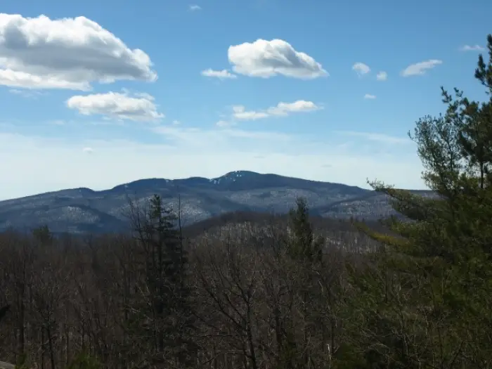
I had seen this mountain many times from Route 28 as I traveled south toward North Hudson, but never really placed the name with the face, so to speak, but once I summited I soon realized where I was standing. Finally the feel of spring was here and I was looking forward to hiking in warm weather and less layers. The week before I was in Old Forge on a hike, and to my surprise the snow was still very deep, especially on the northern aspect of the mountains, so we didn’t want to take any chances.
What gear to bring???
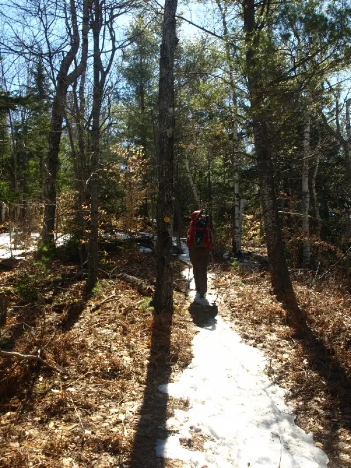
We decided it would be wise to bring our snowshoes and Microspikes along just in case, if nothing else we could leave them in the car, and we would be traveling up the north side of the mountain ridge. As we arrived at 14th Road and started our drive down, my eyes wandered over at the northern slopes of the mountains in the area and it was quite apparent there was still plenty of snow lingering around. Even with the hard winter snowpack from heavy use, we felt there was a good chance that the snow would be rotten and not support us at all without the use of snowshoes. As much as we didn’t want to bring them, we strapped them onto our packs; if nothing else we could use the added weight for an additional dose of exercise.
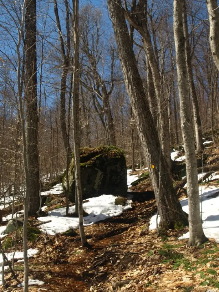
We parked at the top of the hill and started the descent along the dirt road for all of 0.2 miles to the new state trailhead on the left. There would be ample parking here, if it were not under water. We started up the trail that still had a bit of ice on it, but no real snow to speak of. We now realized we would be taking our snowshoes for a tour on our backs. We did however decide to slip on the Microspikes, as traction was not at all good. The ice parted in areas where massive amounts of rushing water crossed the trail. It truly wasn’t long before the Microspikes were not really necessary. The trail became clear of snow and ice as we started to crest the first small bump along the ridge and the southern slopes mountain collected more warmth from the sun. We now were giving the tour to a set of Microspikes - if we hadn’t brought them though we would have needed them - it's Mother Nature’s cruel joke.
The views from Moxham
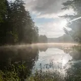
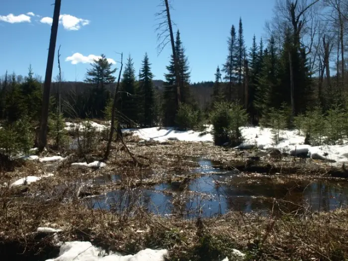
We came to our first view and it was quite amazing. Through the leafless trees we could see the High Peaks around Upper Works, but it was still too obstructed by the forest for any decent photographic opportunities. A long descent brought us to a lower elevation, and a bit of snow started to appear again. As we approached the valley we noticed that we were coming to a small hidden pond that would be on our left, we investigated a bit only to find it was a beaver pond that had all but dried up to a stream running through it. The stream however, maybe small in the summer’s heat was now raging with snowmelt. The trail crossed at a spot not good for the future of our dry boots so we moved slightly upstream and over a downed tree that allowed us to rock-hop a couple well-positioned steps.
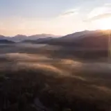
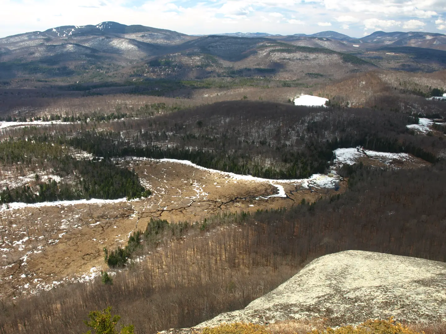
Back in the snow we were, as we ascended through a shallow valley. Though the snow was very rotten and water raced beneath it, we opted not to reapply our traction for the short distance it would be needed to gain the ridge again. As we battled a short pitch of slightly steeper terrain and old waterfall ice, we realized we would be once again on a trail of reddened pine needles. The views soon became more and more frequent and my camera would spend more time out of the case than in. The pillow-like clouds above us formed interesting shapes and added to the depth of the views out toward Gore, Blue, and in the distance, Crane Mountain. The unique shape of Snowy Mountain and Indian Lake’s Little High Peaks were even further in the distance, expanding this view for many miles.
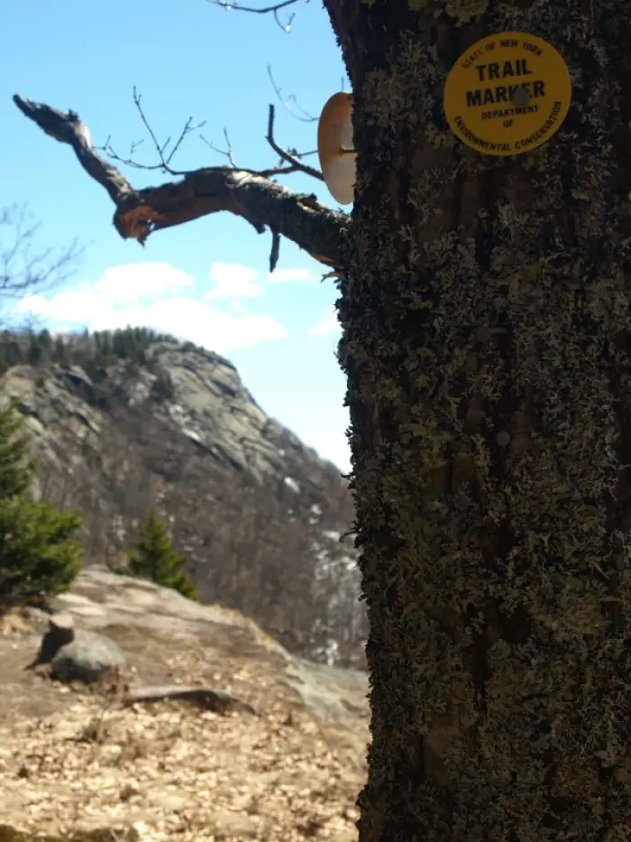
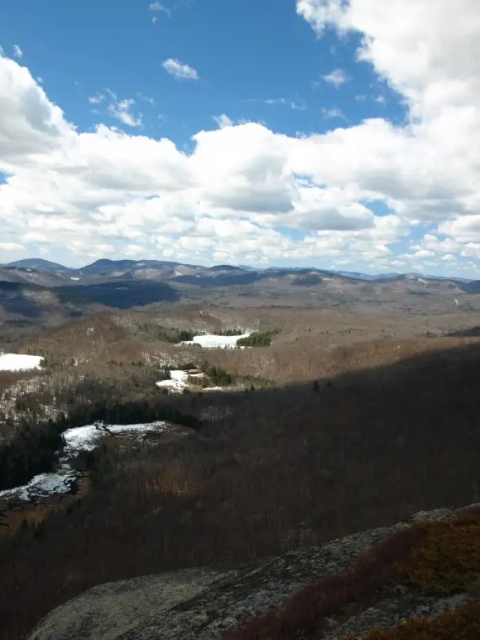
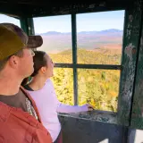
We would soon be close to the summit and the nearly sheer cliffs of Moxham would be in sight capturing our imagination and awe. I had hoped that the trail would follow the tops of the cliffs, but even though it didn't, the line accessed them in several locations for additional views, slightly different from the last. We stood atop the summit of Moxham, gazing at the array of different views of the mountainous landscape and the frozen wetlands below. My camera was smoking from the constant shuttering of pictures, as a cool - not all that gentle - breeze pushed through our hair. It was so pleasant to be able to sit on a summit and enjoy its beauty for longer than 5-minutes. The winter had been long and even the most attractive summits of the cold season pushed us off the summits faster than we had preferred. It was nice to not have to wear snowshoes - even though we carried them. Our only regret was not bringing real food for lunch and having to settle for granola and a Clif Bar.
Our descent was fast and agile. With every step we gained three atop the slippery snow. We stepped and glided as much as we could, when we could, and what was to our slight disadvantage on the way up was our life flight on the way out. Soaked from the knees down from running water and wet snow, we wasted no time in changing into dry footwear for the ride home. Now off to Stewarts for a couple dogs and cone.